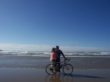
She said: It was another beautiful day in the mountains. Met Paul at the Continental Divide and got my history lesson about the area. Chief Joseph (who the pass is named after) was a peace loving Chief of the Nez Perce tribe. The US military pushed them out of their territory and after a bloody massacre in the middle of the night forced the Nez Perce to surrender. The pass on the road that parallels the route we took is named after the General that led the battle, Gibbons Pass. We are following the Lewis and Clark trail from 1804-1806 and there are historical markers everywhere. Quite interesting. I'm glad I have a road to follow. When I look around while I'm driving through these wide open valleys and huge mountains I wonder how they knew where to go! We are staying in Stevensville, MT tonite, just 26 miles from Missoula- the home of Adventure Cycling Association and the University of Montana. We will be there tomorrow morning and Paul will have his bicycle tuned up, a new cable installed and be in business for the last push of the trip. The owners of the motel we are staying in are from Alaska. They spent 9 years sailing in the Pacific, lived in Australia and New Zealand and then once their daughter was school age, came back to the States, bought an old Historical building and converted it back into a hotel. Pretty cool. Like I said, another great day on the road.

Just after leaving Wisdom-I thought the cloud on the mountain was cool.


While we were at the pass we heard a very loud bird in the trees-Paul called him Chief Joseph, and he sat there the whole time we were there-didn't quite get a picture of him.
Relaxing at the pass. 47 degrees

Not going to Idaho just yet!

Hanging out in Darby MT for lunch-anybody need an outhouse?-we can get you one!

Longhorn sheep made out of horseshoes.

Beautiful ranches with the mountains in the background all along the route this afternoon.

Another Continental Divide-thumbs up!

While we were at the pass we heard a very loud bird in the trees-Paul called him Chief Joseph, and he sat there the whole time we were there-didn't quite get a picture of him.

Relaxing at the pass. 47 degrees

Not going to Idaho just yet!

Hanging out in Darby MT for lunch-anybody need an outhouse?-we can get you one!

Longhorn sheep made out of horseshoes.

Beautiful ranches with the mountains in the background all along the route this afternoon.
No comments:
Post a Comment