Monday, August 31, 2009

Day 39- To the moon, Alice!

He said: Had a good start, little bit warmer day. First 40 miles were a breeze. Then I had to get on to a 75 mph highway into a strong headwind. Not a good breeze. Was on the highway for 11 miles, never came close to the speed limit. They had signs posted, chance of strong winds next 10 miles....I wonder what strong is. Met Sharon in Rawlins for lunch and then it was back on the road into no man's land. Our destination was supposed to be camping at Ma's Kitchen in Lamont, WY, but when we got there Ma was gone. No camping, no food, no nothing. Already had 96 miles in and we knew the Continental Divide was up the road so I figured I'd ride to that. Got there and it was 98 miles and I'd had enough. We had another 9 miles to Muddy Gap where there was supposed to be camping available. NOT! We made the executive decision to cheat---went on to Jeffrey City where there was supposed to be camping, groceries, restaurant. Restaurant was the only business left in town. Had a nice conversation with a guy who told us we needed to go to Lander where he lives to find anything....Lander was 60 miles away. So we went, cutting 100 miles off our trip--oh well. Start again tomorrow.
She said: Had breakfast with some real cowboys this morning and then hit the road. The scenery in the early part of the day was pretty much like yesterday-big ranches with wide open spaces-the roads look like Kansas with mountains off in the distance. We went through the town of Sinclair which is the home of Sinclair refinery. When I started seeing Sinclair gas stations in Kansas I was surprised-I thought they were no longer in existence-I guess I was wrong. After the first 40 miles or so the scenery started to change, much less green, and strange topography. When Paul and I were riding to Lander we commented that it really did look like the moon. Hence our title for today. When we got to Jeffrey City it was the third disappointment, and we were getting a bit frustrated. The guy we met outside the restaurant who told us we had to head to Lander to find a place explained that Jeffrey City used to be a Uranium mining town and was still in good shape until the 80's when the mines closed. Lots of these ghost towns around. It was pretty cool to cross the Continental Divide twice today-we have a few more crossings before we're done. Hopefully the wind wil have calmed some tomorrow.

Did we say rustic? Inside our accomodations last night.

We had one inside too-this was in case we both had to go at the same time.

Some of the early scenery-it was hazy today.

The days first crossing.

The scenery started to change.

Crossing #2.

Sunday, August 30, 2009

Day 38-No fun riding with rain up your butt,cowboy!

He said: What a difference a good nights sleep makes. Last night we went into town and ate a nice meal at the first brick building in Granby. It had been a hardware store, grocery store, etc. etc. but now is a restaurant. Food was good, and thought of our friend Nicole because the name was Brickhouse 40. We heard Brickhouse the other day too! We were at about 7900' and because of the low altitude we both slept like babies (well babies that sleep well anyways). Got a good start at 8, once it warmed up to the low 40's. Had a 23 mile run to Willow Creek Pass, another Continental Divide, at about 9500'. Stopped at a little seasonal gift shop in Rand (June to November) and continued on to Walden for lunch-23 miles from the Wyoming border. This is a big Moose hunting area. You can see the one that Sharon got this morning. They have an instant taxidermy shop. So it was ready when lunch was, but we have to have it shipped. Once again we were under threat of thunderstorms and as I left Walden it started to rain and lightning in the distance. Sure enough started raining but managed to make it to the Wyoming line where Sharon was waiting for the photo op before it got serious. Sat out the serious part of the storm and took off for Riverside Wyoming, our final destination for the night. Coming into town there is a sign that says "Riverside Population 59 Elevation 7320" . Had a great home cooked meal at the Bear Claw Cafe and Saloon, then got a rustic cabin for the night as more thunderstorms were predicted. We had to go back across the street to the cafe for wireless service because Sharon is religious about this blog, and they also had homemade cherry pie, which is Sharon's favorite. Head towards Yellowstone tomorrow, should be there by the end of the week. Looking forward to it. 106 miles.
She said: Took a short bike ride into town to the Lava Java (have to get that coffee fix) loaded up the car, and took off for the Continental Divide. Went on to Rand and browsed in a very nice gift shop that advertised maps, nature books, local artisans and more. Mindy, there was a plaque in front of some gourmet chocolates they were selling, that made us think of you. It said, Chocolate is the answer to everything, who cares what the question is. Went on to the Moose Watching Capital of the World, Walden, Co., but I didn't see any-except for the one I shot. Went to the town history museum and then took off for the state border as the skies were turning dark. Got the photo op just in time, saw some pretty impressive lightning bolts, and when the rain slowed Paul left for Riverside-about 28 miles from the border. We are staying in a rustic cabin-no camping in thunderstorms for me. Had to come back across the street to the cafe as we have no cell service and can't use the wireless card. I was forced to eat a piece of cherry pie a la mode! The ride today kept bringing back visions of watching Bonanza on TV. I could picture Hoss and Little Joe riding off to check the back 40 (more like 40,000!). We saw a ranch about 7 miles from the Wyoming border-it was called "State Line Ranch", we're guessing it went to the state line.
Yippee-made it to Willow Creek Pass!
Sharon had to run up a hill to get into this picture-she's getting pretty fast! Check out Paul's new fashion statement, kind of like wearing fishing waders.
More peaks in the distance.
Not much crime in Rand. He's guarding the Yacht Club.
Not many Yachts in Rand-closed for business-someone should tell the Sheriff.
All those little dots are big bales of hay.
The one that didn't get away.
Welcome to Wyoming-check out the black clouds overhead.

Saturday, August 29, 2009

Day 37-Colorful Colorado

He said: Good news, bad news. Alot of downhill today. 8 miles out, flat tire #2. Luckily there was a sizable breakdown lane so I could flip my bike over, take off the rear tire, put a new tube in, pump it up with my hand pump, and back in business. 8.1 miles out, flat tire #3. Same breakdown lane, same procedure. But this time, I inspect the tire to see what caused the problem. Small piece of metal through the tire, kind of like a heavy duty staple, pulled it out. Now I have to find the hole in either tube since I used my spare tube. Find the hole in one, patch it, pump it up with my hand pump, and the nozzle breaks off the tube. Tear the tube apart, take the next tube, can't find the hole as the hand pump doesn't exert enough pressure as I'm pumping to locate the hole. SAG angel to the rescue! Used tube from worn out tire in place, pumped up, back on the road. If you think about what a marketing campaign would be like to try and lure people to different areas either to live or vacation, if you pictured natures splendor, that's what I was riding through today. Alot of the early day along the Blue River, a beautiful, clean river. Then a detour off the main route which took us up above Green Mountain Reservoir with Green Mountain nearby. Then back down over the dam at the end of the reservoir and out to the original route. Along the Colorado River and through a canyon and back out still along the Colorado River. Plenty of access for sportsmen, whether it's fishing, sailing, canoeing etc. Most access points have bathrooms and campsites. This is for Craig, saw at least 100 fly fishermen in the rivers today and south where we had come from there had been a fly fishing competition that ended yesterday. Saw 4 mule deer above the lake, and some pretty neat looking birds. We started at 9500' and came down to 7600'. Now we have to go over the Continental Divide again at 9500'. Was hoping to make it over today, but it was still 23 miles away uphill with rain fast approaching, so called it a day at 67 miles in Granby, Co.
She said: The altitude is something you really have to respect around here-you can really feel the difference. I was glad to make the 2000' descent today, I think Paul was too. It feels better to know we will get a good nights sleep tonite. The last few nights were a bit restless, just trying to breathe. I guess it takes some time to adapt. Anyway-Paul took off this morning with plans to meet a few hours down the road. Got a call fairly early that he was having some tire problems, so off I went. The weather was looking a bit iffy all day, so we didn't stay far away from each other. The scenery was just beautiful today. Saw the headwaters of the Colorado River and followed it for a good part of the day. There were many cyclists riding, fishermen fishing, and boaters boating. With dark clouds overhead and black ones not far up ahead, we decided to call it a day in Granby, Co. as we were at least 28 miles from the next town with a big pass to go over. The train tracks followed the river and our route a good portion of the day. The tracks are across the street from where we are staying tonite and so far 2 trains have gone by-a passenger train, and a coal train. Hopefully they won't be running through the night.

The Trans-Am brings you off the main road and around this reservoir.

You can see SR-40 across the water.

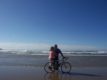
Some of the scenery we saw today.

At the top of the dam.......

and from across the bridge.

The river flowing through the canyon. Hey Craig, if you click on this picture to enlarge it, you can see the fly fishermen.

Riding through the canyon.

Friday, August 28, 2009

Day 36-Rest day-then why is Sharon exhausted?

She said: Today was a "rest day" for Paul. We drove to Frisco-about 5 miles from where we are staying to go to a bike shop for some supplies for Paul, and to ride on the bike path in town. We began on the bike path in the downtown area and started riding around the reservoir area. There was an 18 mile loop that circled the reservoir, so we started off in that direction. It was fairly flat and I was doing just fine, so we continued on through some beautiful areas around the reservoir. Just when we were more than halfway around the hills started to get a bit steep, and I started sucking wind-there isn't much at 9500' to suck, and we didn't bring any water with us either-not smart. Well, I wasn't turning back, so with some walking and peddling-we made it around the loop. Paul was very patient-it was just a Friday morning ride in the park for him. Got back to Frisco, had a nice lunch, walked around the downtown, and then headed back to Silverthorne-where we were staying. Played some Nertz-Paul is ahead in the series 5 to 3. Went to an outdoor Bluegrass Concert downtown to benefit the town's River project. Talked to a woman working for the Blue River Watershed Group about the Source to Sea program The Last Green Valley had done. Listened to some Blue Grass music and enjoyed watching people of all ages enjoy the concert. Got a bite to eat and headed back to the motel-I'm beat-the thin air and exercise has worn me out!
He said: Break day today, so we took a nice ride around the lake. About a 20 mile ride with a pretty good hill about 3 miles from the end. Sharon did really well especially considering the high altitude and the fact that she hadn't had much time to ride while we've been on the trip. I was proud of the way she hung in there and refused to take the taxi I called. We were both thirsty and famished, had a nice lunch and walked around the town in the afternoon. Went to an outdoor Bluegrass concert, had supper and called it a night. Back on the road tomorrow, heading towards Wyoming.

The beginning of the trail, heading towards the reservoir.

The reservoir supplies water to Denver-about a mile lower in elevation than here.

This one's for John R.-want to sail here?

Looking off in the other direction.

I have to keep going up?

We circled the whole thing.

Words can't describe.

Thursday, August 27, 2009

Day35-Gets to come down!

He said: Clear dry air to start the day. Had to climb 2000' in about 11 miles-with about 1000' of it in the last 4 miles. It was about 38 degrees when I left, but I didn't know that, good thing. Left into a head wind going up hill. The town of Alma was about 6 miles away, and I stopped there to sit in the sun and wait for Sharon to go by. She came and we sat in the sun for about a half hour and I exchanged a light weight jacket for cold weather gear. I realize I am going to need some leg warmers and gloves as we will be above 7000' for much of the next few weeks. Left Alma and spun up the hill. Now that we are in the mountains and hills, whatever, the roads aren't straight anymore so you are guessing what's around the corner all the time. If you don't look at your odometer when you start, or when they have a sign that says how far to the summit, or your basic math is bad cause your brain is frozen and you have oxygen deprivation, you better just keep spinning. Eventually you get there. I did, and Sharon was waiting, and I don't know which site was more welcoming. By the time we got to the summit it had warmed up to a balmy 44, but the winds were still strong. While we were admiring the view, we took pictures of a couple from Boynton Beach, Fl. We don't go around taking pictures of people-it was with their camera for them. The photo op done, they scurried back to their car like crabs to the ocean. They said it doesn't get cold like this in Florida. The road did a U-turn, and around the curve the view was just gorgeous, with green sided mountains, streams along the road side, and panoramic views. I had a down hill coast through alot of S-turns and switchbacks for about 5 miles down into Breckenridge. It is in a gorgeous area, and as a result, it is a booming upscale resort area. Much different from the smaller former mining boom areas. Stopped in Breckenridge for an over-priced breakfast. Sharon went ahead 2 towns to Silverthorne while I continued on bike paths to the same destination. It is incredible how much more is spent and put in place for recreational opportunities in the area, even in the towns that would appear to be less fortunate. Part of the bike path went around a man made lake which is a reservoir that supplies water, via gravity, to the city of Denver. Changed up our routine of 6 days on, one day off so we could take advantage of the abundance of bike shops and outdoor activity in the area, combined with extraordinary scenery. We needed to do laundry cause it doesn't look like we'll be near creature comforts for awhile. Took care of all our "to-do's" today and tonite, so we can enjoy tomorrow. Sharon gets to ride because of the great bike paths. Trans-Am miles today was supposed to be around 36, somehow I managed to turn it into 50. I like to say I take the scenic route, Sharon likes to say I get lost. Oh, and Craig, I've started a trend. People all over the west are now wearing short white socks and flip and flops. 50 miles, one big hill.
She said: Well, it was a big day. Paul spun right over the Hoosier Pass-the highest point on the Transam route. It was pretty cool (literally and figuratively) sitting on the Continental Divide waiting for him to reach the summit. The views were terrific from there. I learned the Continental Divide separates the watersheds of the Atlantic and Pacific Oceans. It is a true line of demarcation. Any rain, snow or snow melt that falls on the west side will eventually end up in the Pacific, and any that falls on the east side will end up in the Atlantic. The road down from the pass was unbelievable, the views were breathtaking, and I was worried I might drive off the road because I was looking around too much. Met Paul in Breckenridge for breakfast, and then went on to Silverthorne. I was working in the library, and after awhile I started to wonder where Paul could be. I've gotten pretty good about figuring how long it should take for his rides based on the terrain, etc., and he was late. He finally arrived, and told me he was on the bike path to Vail. I won't say he got lost on the bike path-he did some extra site seeing! After taking care of odds and ends this afternoon, we took a ride to Breckenridge and spent a nice evening walking around town. Day off tomorrow-going for a ride on the bike path to Frisco and will ride around the reservoir.

At the summit

View across the street from the summit parking area.

Mountain view from Hoosier Pass

Here he comes!

All the way to the top.

Thumbs up Wakelys!

The trusty steed.

Now he gets to go down the mountain.

That's where we were.

They were doing construction on the road and the bike path. They had a flagger on the bike path! Had to stop to wait while they put the bridge in place. That's really why it took me so long.

Wednesday, August 26, 2009

Day 34-What goes up.....

He said: Big thunderstorms last night-poured like crazy. Luckily it was clear by morning and at 6:45 I left in 52 degree weather. Our goal was to get through Currant Creek Pass, elevation 9500' and on to Fairplay. Slow going, but made it over the top, and tomorrow I need to climb another 2000' to get over Hoosier Pass which at 11,500' will be the highest elevation on the trip. Hoosier Pass is about 10 miles away, and then I have alot of downhill into the busy area of Breckenridge, Silverthorne, and Frisco. Today we were in the mountains. Once we got over the Pass the surrounding terrain opened up into a big valley. Quite a big difference. 85 miles.
She said: Today was the biggest elevation change we would make on the trip in one day. We climbed from 5000' to 9500'. The mountains here are so different than the mountains early in the trip. The roads are wider and the climbing is longer with bigger elevation changes on each climb, but less of a grade. My ears were popping as I drove along and you could feel the effects of the high elevation. We're almost in the 2 mile high city! It is amazing to see the mountains all around you and how different the scenery is at every turn. We live in a beautiful country-from the flatlands and prairies to the mountains on the east and west coasts. I'm not the greatest photographer, but I hope all of you can appreciate the country we are seeing and trying to share with you. We are in an area that saw a big boom at the time of the Gold Rush. When the mining dried up some of the miners became ranchers, but for the most part the populations dwindled. Exciting day tomorrow-going over the Hoosier Pass.

What we saw when we first left Florence.

On the road to Curant Creek Pass

I think the mountains are amazing.

One of the only downhills on the way to the Pass. You can see the road way off in the distance.

This little Prairie Dog waited with me for Paul at the 40 mile mark for the day.

Paul said the top of the mountains resemble his ride so far today.

This is ranch country. You see many of these entrances all along the route,

At the 40 mile point in the day-stopped at a realtors office (closed) and used their bench for a rest and a snack. Nothing else in the area for at least 25 miles.

These guys didn't have a SAG team-went off route to Guffey, Co. where they said there was food. NOT!

The road after Currant Creek Pass. We were in a big valley in between mountain tops. The road is off in the distance as far as you can see in the picture.

Just over the Pass. Yeah!

On the way to Fairplay.